Tuesday, July 31, 2018

Cape Flattery

 We went to Cape Flattery, the most north western part of the continental United States.
 It was like being in another world.  The water was aqua and the caves looked like a movie set.
 Cape Flattery looks out on Tatoosh Island where the Strait of Juan de Fuca meets the Pacific.
 This is the lighthouse on Tatoosh Island.
 Another amazing view of the inlet and the aqua water.
Purple flowers were growing in the cracks of the stone with no soil!

Port Angeles

 Logging is a major industry in Washington.  We saw lots of logging trucks and logging barges.
 This was a mural we saw when we took a walking tour of Port Angeles.
Because of the flooding the city needed to be built up.  It took 400+ loggers working 24 hour shifts when they could not log to lift the city up.  They raised the buildings and set them on redwood beams and put in concrete walls to hold the dirt they used to fill in the streets.  They used 5 gallon buckets to pour the concrete and there are no cracks in the walls they poured.  This is the underground floor of one of the buildings they raised.

Waterfalls in Olympic National Park

 We drove about 1 hour and hiked to Sol Duc Falls.  Whey were amazing as they separated into 3 falls all filled with rushing water.
 Then we drove about 1/2 hour and hiked to Marymere Falls, another beautiful sight.
The last fall along the 101 was Madison Falls, which was on a road marked "Elwah Visitors Center Closed"!  It was an easy walk to this falls!

Olympic National Park

 On the day we arrived in Port Angeles, we drove up to Hurricane Ridge to see the Olympic Mountains.  The glaciers were clearly visible.
The mountains are very majestic.  They are not always visible due to clouds, fog, or smoke from Canadian wildfires.

Tuesday, July 24, 2018

 We spent 2 days exploring Mt. Rainier.  We thought it was going to be cold, but it was in the 80s!
 Mt. Rainier has 25 glaciers that are very deep.  It is an active volcano and can heat up the snowfall and cause devastating floods and rock fall at any time.  There are signs all around telling you where the volcano evacuation routes are and to go for higher ground if you feel the earth move.
 This was taken at Paradise Visitors Center and you can see where the magma and lava flowed.
 We walked to the base of Narada Falls and were astonished to see the rainbow at the bottom.
This is a view of Emmons Glacier, the largest one on Rainier.
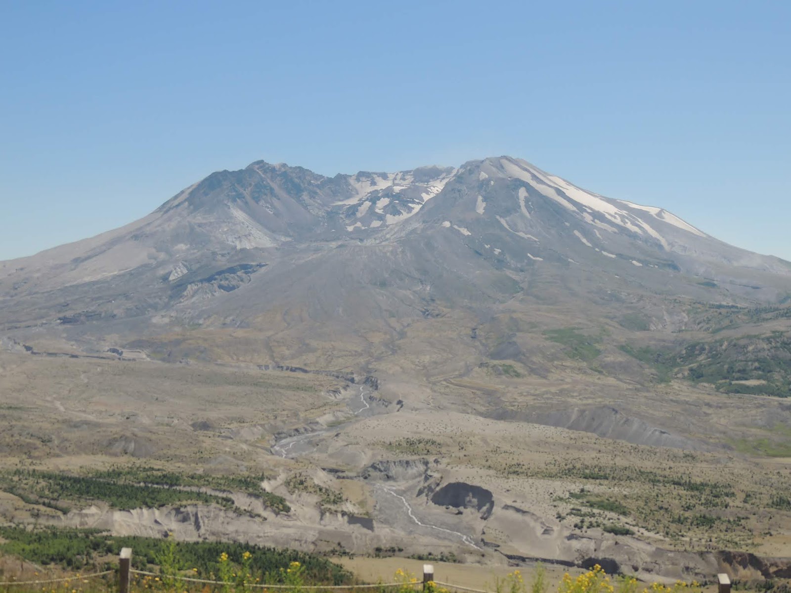
 Our first trip was to Mt. St. Helens which erupted in 1980 and destroyed 150,000 acres.  Everything in this picture was gone.  The part that is green was replanted by Weyerhauser as the land was owned by they.  Federal lands had to recover by themselves so scientists could study the process.
 The mountain was growing 5 feet a day on this, the north side, before it erupted.  There was only 1 seismograph there to measure the 10,000 earthquakes that preceded the eruption.  The explosion which was equal to the force of multiple atomic bombs was not heard by anyone nearby because it went straight up!
 The animals are slowly returning to the land as evidenced by this herd of elk grazing.
The eruption tore down 150 ft trees and carried them along with the magma increasing the devastion.  The flow was whiter than usual because of the extreme density of the pumice-like quality of the magma.  There was no red like there is in the Hawaiian volcano which is more liquid.

Summer 2018

After driving thru the scorching heat, it was 108 in Stockton, 106 in Phoenix,Oregon, just south of Medford, we arrived at our campground in Silver Creek, WA.  We are camped alongside Mayfield Lake in a wooden campground.  They, too, are having a heat wave, but it is only in the high 80s!